| |
|
 |
|
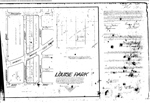
| Louise Park |
|
 |
|
| The M S Foster Plat |
|
|
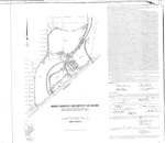 |
| Main Campus University of Miami |
|
|
| Main Campus University of Miami |
|
 |
|
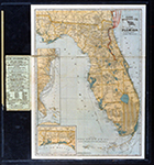
| Map and Seal of Florida |
|
|
 |
| Map made for the U.S. Coast and Geodetic Survey of Cape Sable : East Cape to Shark River, April 12, 1928 |
|
|
| Map made for the U.S. Coast and Geodetic Survey of Cape Sable : East Cape to Shark River, April 12, 1928 |
|
 |
| Map of Boynton Beach drawn by Lyman Boomer, 1910 |
|
|
| Map of Boynton Beach drawn by Lyman Boomer, 1910 |
|
|
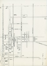 |
| Map of Boynton streets, c. 1945 |
|
|
| Map of Boynton streets, c. 1945 |
|
 |
|
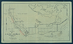
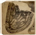
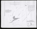
| Map of Cape Sable. |
|
|
 |
|
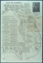
| Map of Florida |
|
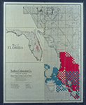 |
| Map of Florida 500,000 acres choice prairie farming lands in Florida. |
|
|
| Map of Florida 500,000 acres choice prairie farming lands in Florida. |
|
|
 |
| Map of Florida showing routes and railroad connections. |
|
|
| Map of Florida showing routes and railroad connections. |
|
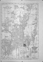 |
| Map of Greater Miami Florida |
|
|
| Map of Greater Miami Florida |
|
|
 |
| Map of Indian Creek Golf Club (Miami Beach, Fla.) |
|
|
| Map of Indian Creek Golf Club (Miami Beach, Fla.) |
|
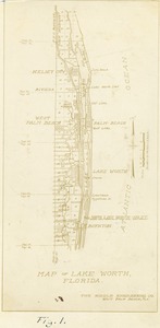 |
| Map of Lake Worth Florida, 1925 |
|
|
| Map of Lake Worth Florida, 1925 |
|
|
 |
| Map of Matheson Hammock Park |
|
|
| Map of Matheson Hammock Park |
|
 |
|
| Map of Miami to Key West |
|
|
 |
|
| Map of Miami to Key West |
|
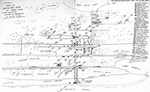
![Map of South Florida. 19--]](http://dpanther.fiu.edu/sobek/content/MW/00/99/00/02/00001/001a_thm.jpg) |
| Map of South Florida. 19--] |
|
|
| Map of South Florida. 19--] |
|
|
 |
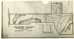
| Map of the Virginia Key Abandoned Military Reservation |
|
|
| Map of the Virginia Key Abandoned Military Reservation |
|
 |
|
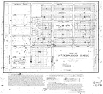
| Map of Wynwood Park |
|

