| |
|
![[Aerial views of Miami Beach, showing sections of man-made island areas, 1941-1959].<br />( 12 volumes )](http://dpanther.fiu.edu/sobek/content/MB/00/00/13/71/00001/1371_10_000thm.jpg) |
| [Aerial views of Miami Beach, showing sections of man-made island areas, 1941-1959]. |
|
|
[Aerial views of Miami Beach, showing sections of man-made island areas, 1941-1959].
( 12 volumes ) |
|
![[Collection of the Washington Federal of Miami Beach publication, The Dividend, 1959-1964]<br />( 13 volumes )](http://dpanther.fiu.edu/sobek/content/MB/00/00/09/66/00001/966_1_001thm.jpg) |
| [Collection of the Washington Federal of Miami Beach publication, The Dividend, 1959-1964] |
|
|
[Collection of the Washington Federal of Miami Beach publication, The Dividend, 1959-1964]
( 13 volumes ) |
|
|
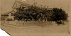 |
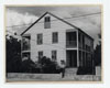
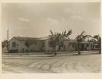
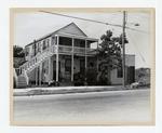
| 1029 & 1025 Fleming Street |
|
|
| 1029 & 1025 Fleming Street |
|
 |
|
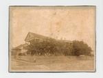
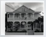
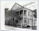
| 1029 Fleming Street |
|
|
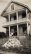 |
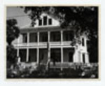
| 1401 Olivia St. with Lewis family on porch |
|
|
| 1401 Olivia St. with Lewis family on porch |
|
 |
|
| 1431 Duncan Street |
|
|
 |
|
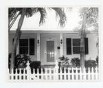
| 227 Duval Street |
|
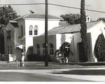 |
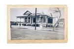
| 379 NE 94th Street - Corner view |
|
|
| 379 NE 94th Street - Corner view |
|
|
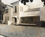 |
| 379 NE 94th Street - Front view from angle |
|
|
| 379 NE 94th Street - Front view from angle |
|
 |
|
| 408 William Street |
|
|
 |
|
| 410 Fleming street |
|
 |
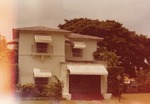
| 440 NE 92nd Street - Front view from angle |
|
|
| 440 NE 92nd Street - Front view from angle |
|
|
 |
|
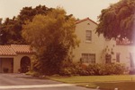
| 453 NE 92nd Street |
|
 |
|
| 469 NE 91st Street |
|
|
 |
|
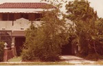
| 482 NE 93rd Street |
|
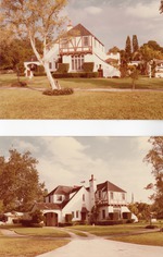 |
| 501 NE 94th Street - Two pictures: Front and corner view |
|
|
| 501 NE 94th Street - Two pictures: Front and corner view |
|
|
 |
|
| 506 South Street |
|
 |
|
| 525 Duval Street |
|
|
 |
| 600 block of United Street |
|
|
| 600 block of United Street |
|
 |
|
| 620 Eaton street |
|

