| |
|
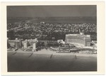
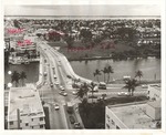
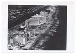
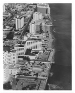
![[Aerial views of Miami Beach, showing sections of man-made island areas, 1941-1959].<br />( 12 volumes )](http://dpanther.fiu.edu/sobek/content/MB/00/00/13/71/00001/1371_10_000thm.jpg) |
| [Aerial views of Miami Beach, showing sections of man-made island areas, 1941-1959]. |
|
|
[Aerial views of Miami Beach, showing sections of man-made island areas, 1941-1959].
( 12 volumes ) |
|
![[Collection of documents regarding Miami Beach 50 Years Anniversary celebrations, 1965].<br />( 2 volumes )](http://dpanther.fiu.edu/sobek/content/MB/00/00/10/03/00001/1003_002thm.jpg) |
| [Collection of documents regarding Miami Beach 50 Years Anniversary celebrations, 1965]. |
|
|
[Collection of documents regarding Miami Beach 50 Years Anniversary celebrations, 1965].
( 2 volumes ) |
|
|
![[Collection of pamphlets and books on Florida history, environment and industry].<br />( 11 volumes )](http://dpanther.fiu.edu/sobek/content/MB/00/00/11/01/00001/1101_1_001thm.jpg) |
| [Collection of pamphlets and books on Florida history, environment and industry]. |
|
|
[Collection of pamphlets and books on Florida history, environment and industry].
( 11 volumes ) |
|
![[Views of Collins Avenue in the 1990s].<br />( 7 volumes )](http://dpanther.fiu.edu/sobek/content/MB/00/00/10/99/00005/1099_5_01_000thm.jpg) |
| [Views of Collins Avenue in the 1990s]. |
|
|
[Views of Collins Avenue in the 1990s].
( 7 volumes ) |
|
|
![[Views of local government events, awards, buildings, and city planning during 1977].<br />( 25 volumes )](http://dpanther.fiu.edu/sobek/content/MB/00/00/17/05/00001/1705_03_001thm.jpg) |
| [Views of local government events, awards, buildings, and city planning during 1977]. |
|
|
[Views of local government events, awards, buildings, and city planning during 1977].
( 25 volumes ) |
|
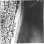 |
| Aerial survey photographs of Miami Beach between Lummus Park to Government Cut. |
|
|
| Aerial survey photographs of Miami Beach between Lummus Park to Government Cut. |
|
|
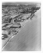 |
| Aerial view of Miami Beach, looking north from Seventy-first Street |
|
|
| Aerial view of Miami Beach, looking north from Seventy-first Street |
|
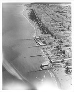 |
| Aerial view of the beach looking south at Lummus Park from the vantage point of Seventeenth Street |
|
|
| Aerial view of the beach looking south at Lummus Park from the vantage point of Seventeenth Street |
|
|
 |
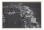
| Aerial views of Miami Beach |
|
|
Aerial views of Miami Beach
( 2 volumes ) |
|
 |
| Aerial views of Miami Beach, 1950s |
|
|
| Aerial views of Miami Beach, 1950s |
|
|
 |
| Aerial views of Miami Beach, 1960s |
|
|
| Aerial views of Miami Beach, 1960s |
|
 |
| Aerial views of Miami Beach and surrounding islands, 1960-1970 |
|
|
| Aerial views of Miami Beach and surrounding islands, 1960-1970 |
|
|
 |
| Aerial views of oceanfront buildings showing parks and beach erosion between Fisher Island and Halouver Pass, 1969 |
|
|
| Aerial views of oceanfront buildings showing parks and beach erosion between Fisher Island and Halouver Pass, 1969 |
|
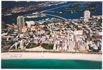 |
| Aerial views of South Beach, Government Cut, Miami Beach Marina, MacArthur Causeway and Islands, early 2000s |
|
|
| Aerial views of South Beach, Government Cut, Miami Beach Marina, MacArthur Causeway and Islands, early 2000s |
|
|
 |
| Aerial views of the City of Miami Beach and the City of Miami 1960-1970 |
|
|
| Aerial views of the City of Miami Beach and the City of Miami 1960-1970 |
|
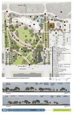 |
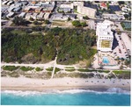
| Altos Del Mar Park master plan |
|
|
| Altos Del Mar Park master plan |
|
|
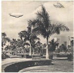 |
| Bayfront Park with aircraft drawn in, Miami, Florida, 1931 |
|
|
| Bayfront Park with aircraft drawn in, Miami, Florida, 1931 |
|
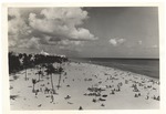 |
| Beach goers at the beach, mid 1950s |
|
|
| Beach goers at the beach, mid 1950s |
|
|
 |
| Boardwalk and beach scenes and aerial views, 1990s |
|
|
| Boardwalk and beach scenes and aerial views, 1990s |
|
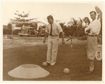 |
| Bobby Dosh and B.C. Wheeler playing codeball at Flamingo Park, 1934 |
|
|
| Bobby Dosh and B.C. Wheeler playing codeball at Flamingo Park, 1934 |
|

