| |
|
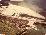 |
| Aerial view of Holiday Isle Resort |
|
|
| Aerial view of Holiday Isle Resort |
|
![[1890] Whitmarsh Lane & Angela Street](http://dpanther.fiu.edu/sobek/content/MM/00/00/85/97/00001/53186___MM00008597_thm.jpg) |
| Whitmarsh Lane & Angela Street |
|
|
| [1890] Whitmarsh Lane & Angela Street |
|
|
![[1890] 900 block of Whitehead Street](http://dpanther.fiu.edu/sobek/content/MM/00/00/86/51/00001/52531___MM00008651_thm.jpg) |
| 900 block of Whitehead Street |
|
|
| [1890] 900 block of Whitehead Street |
|
![[1909] Navy Yard after the hurricane](http://dpanther.fiu.edu/sobek/content/MM/00/00/08/25/00001/51531_MM00000825_thm.jpg) |
| Navy Yard after the hurricane |
|
|
| [1909] Navy Yard after the hurricane |
|
|
![[1928] East Martello and Meacham Field Key West](http://dpanther.fiu.edu/sobek/content/MM/00/00/32/59/00001/51557_MM00003259_thm.jpg) |
| East Martello and Meacham Field Key West |
|
|
| [1928] East Martello and Meacham Field Key West |
|
![[1930] The corner of Whitehead and Truman looking northwest](http://dpanther.fiu.edu/sobek/content/MM/00/00/02/83/00001/42800_MM00000283_thm.jpg) |
| The corner of Whitehead and Truman looking northwest |
|
|
| [1930] The corner of Whitehead and Truman looking northwest |
|
|
![[1930] Fort Jefferson aerial](http://dpanther.fiu.edu/sobek/content/MM/00/00/10/04/00001/51349_MM00001004_thm.jpg) |
|
| [1930] Fort Jefferson aerial |
|
![[1930] Aerial view of Hotel Casa Marina looking northeast to Garrison Bight](http://dpanther.fiu.edu/sobek/content/MM/00/00/04/83/00001/51433_MM00000483_thm.jpg) |
| Aerial view of Hotel Casa Marina looking northeast to Garrison Bight |
|
|
| [1930] Aerial view of Hotel Casa Marina looking northeast to Garrison Bight |
|
|
![[1930] Key West bight looking south](http://dpanther.fiu.edu/sobek/content/MM/00/00/04/84/00001/51165_MM00000484_thm.jpg) |
| Key West bight looking south |
|
|
| [1930] Key West bight looking south |
|
![[1930] Duval from South street looking north west](http://dpanther.fiu.edu/sobek/content/MM/00/00/57/22/00001/MM00005722_thm.jpg) |
| Duval from South street looking north west |
|
|
| [1930] Duval from South street looking north west |
|
|
![[1936] Aerial view of Fort Taylor looking northeast across Key West](http://dpanther.fiu.edu/sobek/content/MM/00/00/02/86/00001/50990_MM00000286_thm.jpg) |
| Aerial view of Fort Taylor looking northeast across Key West |
|
|
| [1936] Aerial view of Fort Taylor looking northeast across Key West |
|
![[1936] Key West aerial view looking east to Stock Island](http://dpanther.fiu.edu/sobek/content/MM/00/00/02/89/00001/50992_MM00000289_thm.jpg) |
| Key West aerial view looking east to Stock Island |
|
|
| [1936] Key West aerial view looking east to Stock Island |
|
|
![[1940/1949] Bush Key with Fort Jefferson in the background](http://dpanther.fiu.edu/sobek/content/MM/00/00/54/11/00001/53120___MM00005411_thm.jpg) |
| Bush Key with Fort Jefferson in the background |
|
|
| [1940/1949] Bush Key with Fort Jefferson in the background |
|
![[1940] Swimming pool and boat house at Casa Roma](http://dpanther.fiu.edu/sobek/content/MM/00/01/28/88/00001/_thm.jpg) |
| Swimming pool and boat house at Casa Roma |
|
|
| [1940] Swimming pool and boat house at Casa Roma |
|
|
![[1940/1949] Fort Jefferson](http://dpanther.fiu.edu/sobek/content/MM/00/01/32/52/00001/70496___MM00013252-1_thm.jpg) |
|
| [1940/1949] Fort Jefferson |
|
![[1941] An aerial photo of the Naval Hosptial site, golf course, and Highway One](http://dpanther.fiu.edu/sobek/content/MM/00/01/22/91/00001/53240___MM00012291_thm.jpg) |
| An aerial photo of the Naval Hosptial site, golf course, and Highway One |
|
|
| [1941] An aerial photo of the Naval Hosptial site, golf course, and Highway One |
|
|
![[1941] An aerial view of the Naval Hosptial site, Casa Roma, North Roosevelt, and Highway One](http://dpanther.fiu.edu/sobek/content/MM/00/01/22/92/00001/52678___MM00012292_thm.jpg) |
| An aerial view of the Naval Hosptial site, Casa Roma, North Roosevelt, and Highway One |
|
|
| [1941] An aerial view of the Naval Hosptial site, Casa Roma, North Roosevelt, and Highway One |
|
![[1941] A southwest aerial view of Duval and Whitehead Streets and the Naval Station](http://dpanther.fiu.edu/sobek/content/MM/00/00/58/84/00001/53294___MM00005884_thm.jpg) |
| A southwest aerial view of Duval and Whitehead Streets and the Naval Station |
|
|
| [1941] A southwest aerial view of Duval and Whitehead Streets and the Naval Station |
|
|
![[1941] An aerial view of Key West Bight & the Navy's Trumbo Point](http://dpanther.fiu.edu/sobek/content/MM/00/00/82/57/00001/52766___MM00008257_thm.jpg) |
| An aerial view of Key West Bight & the Navy's Trumbo Point |
|
|
| [1941] An aerial view of Key West Bight & the Navy's Trumbo Point |
|
![[1941] Navy's Fleming Key under construction](http://dpanther.fiu.edu/sobek/content/MM/00/00/73/56/00001/53333___MM00007356_thm.jpg) |
| Navy's Fleming Key under construction |
|
|
| [1941] Navy's Fleming Key under construction |
|

