|
|
| |
|
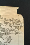 |
| Map made for the U.S. Coast and Geodetic Survey of Cape Sable : East Cape to Shark River, April 12, 1928 |
|
|
| Map made for the U.S. Coast and Geodetic Survey of Cape Sable : East Cape to Shark River, April 12, 1928 |
|
 |
|
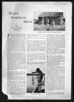
| 'Neath southern skies |
|
|
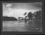 |
| Photographs depicting Shark River and environs, 1929. |
|
|
| Photographs depicting Shark River and environs, 1929. |
|
|
|

