| |
|
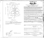 |
| Amended Plat of a Portion of Coral Bay Section "C" |
|
|
| Amended Plat of a Portion of Coral Bay Section "C" |
|
 |
| An atlas of eastern Broward County surface water management basins |
|
|
| An atlas of eastern Broward County surface water management basins |
|
|
 |
| An atlas of eastern Palm Beach County surface water management basins |
|
|
| An atlas of eastern Palm Beach County surface water management basins |
|
 |
| An atlas of Martin County surface water management basins |
|
|
| An atlas of Martin County surface water management basins |
|
|
 |
| An atlas of St. Lucie County surface water management basins |
|
|
| An atlas of St. Lucie County surface water management basins |
|
 |
| An atlas of surface water management basins in the Everglades: THE WATER CONSERVATION AREAS AND EVERGLADES NATIONAL PARK |
|
|
| An atlas of surface water management basins in the Everglades: THE WATER CONSERVATION AREAS AND EVERGLADES NATIONAL PARK |
|
|
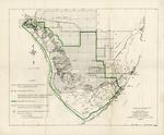 |
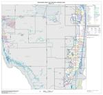
| Proposed final boundary, Everglades National Park, Florida |
|
|
| Proposed final boundary, Everglades National Park, Florida |
|
 |
| A Three-Dimensional Finite Difference Ground Water Flow Model of the Surficial Aquifer System, Broward County, Florida |
|
|
| A Three-Dimensional Finite Difference Ground Water Flow Model of the Surficial Aquifer System, Broward County, Florida |
|
|
 |
| Urbanized area outline map (Census 2000) |
|
|
| Urbanized area outline map (Census 2000) |
|
 |
| Vegetation of Shark Slough, Everglades National Park |
|
|
| Vegetation of Shark Slough, Everglades National Park |
|
|
 |
| Zoning ordinance of the city of Coral Gables, Florida |
|
|
| Zoning ordinance of the city of Coral Gables, Florida |
|
|

